
Basic Overview
- Location & Administration: Xianggelila Town, Daocheng County, Garzê Prefecture; the scenic area entrance visitor center is about 2,900 meters above sea level, with core hiking zones ranging from 3,800 to 4,700 meters.
- Honors & Positioning: National 5A-level tourist attraction; centered on the Tibetan Buddhist belief in the 'Three Dharma Lords', combining high-altitude glaciers, glacial lakes, subalpine meadows, and fir forest ecosystems.
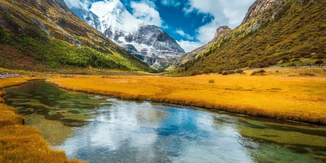
- Xian Nai Ri: 6,032 meters, embodying the Bodhisattva Guanyin, with a broad northern peak; the line from Zhen Hai Po to Chonggu Temple faces directly toward the mountain's reflection.
- Yangmai Yong: 5,958 meters, embodying the Bodhisattva Wenshu, with sharp southern peaks; the most photogenic views are from Luorong Cattle Field and the Yangmai Yong Viewing Platform.
- Xia Luo Duo Ji: 5,958 meters, embodying the Bodhisattva Vajrapani, with rugged eastern ridges; the most dramatic moments occur during golden hour at sunset.
- Popular Evaluation: 'The three sacred mountains encircle a circle, with lakes and meadows nestled inside'; 'Yading isn't about viewing one lake, but seeing the sacred mountains cradling the lakes.'
Core Mountain Viewing Zones
1) Xian Nai Ri – Chonggu – Zhen Hai Po Route (Short Route / Low Altitude Acclimatization)
- Zha Guan Beng (~3,800 meters): Final stop for shuttle buses, where walking begins toward Chonggu Temple/Chonggu Meadow hub.
- Chonggu Temple (~3,900 meters): A key Tibetan Buddhist temple site offering views of the front face of Xian Nai Ri and morning mist over Chonggu Meadow.
- Zhen Hai Po / Zhuoma La Cuo (~4,080–4,100 meters): A mirror-like lake reflecting Xian Nai Ri, requiring about 1.5 km of hiking from Zha Guan Beng round-trip. Allow 2–3 hours overall. The lake surface resembles glass under calm conditions without strong wind or intense sunlight.
- Suitable For: First-day acclimatization, elderly and children, those concerned about altitude sickness; also forms the backbone of the 'ordinary experience route'.
2) Yangmai Yong – Xia Luo Duo Ji – Luorong Cattle Field Route (Middle Route / Starting Point for Long Trail)
- From Chonggu Meadow to Chonggu Temple, take an electric shuttle bus to Luorong Cattle Field (one-way distance: 6.7 km; one-way fare: 50 yuan, round-trip: 80 yuan).
- Luorong Cattle Field (4,180 meters): A grassland where all three sacred mountains appear together, with Yangmai Yong directly ahead and Xia Luo Duo Ji to the side; one of the filming locations for the movie 'From Your Whole World'.
- Suitable For: Photography and leisure walks along the 'Chonggu–Luorong' loop; serves as a base camp for longer hikes to Milk Lake and Five-Colored Lake—the essential waypoint for the 'Vajra Challenge Route'.
Lakes and Meadows: Sacred Lakes Nestled in the Embrace of the Sacred Mountains
Core Lakes
Milk Lake (Erong Cuo): Located in the saddle between Yangmai Yong, officially listed at about 4,500 meters (some trail maps show 4,600 meters), a fan-shaped glacial lake with layered shades of milky blue and emerald green, color determined by minerals and light. The one-way hike from Luorong Cattle Field to Milk Lake via She Shen Ya is about 3.5 km, followed by another 1.8 km from She Shen Ya to the lake’s edge—steep climbing, marking one of the iconic endpoints of the 'Vajra Challenge Route'.
Five-Colored Lake (Danzeng Cuo): Situated between Xian Nai Ri and Yangmai Yong, officially listed at about 4,600 meters, with trail maps indicating 4,700 meters; its colors shift among blue, green, purple, and gray depending on lighting—this is the highest point on the long route. Milk Lake and Five-Colored Lake are typically traversed together in sequence: 'Luorong–She Shen Ya–Milk Lake–Five-Colored Lake–return via original path'.
Zhen Hai Po / Zhuoma La Cuo: Already included in the Xian Nai Ri route, at around 4,100 meters; advantages include short distance, relatively lower elevation, stable reflections, and no competition for energy with the long route—making it the highlight of the 'ordinary experience route'.
Chonggu Meadow + Luorong Cattle Field: Chonggu Meadow connects Chonggu Temple with the electric shuttle bus starting point, offering morning mist, prayer flags, and panoramic views of Xian Nai Ri; Luorong Cattle Field is a high-altitude pasture and a full-viewpoint of the three sacred mountains, serving as a psychological milestone for long-distance trekkers—once past this point, true high-altitude ascent begins.
Best Time to Visit & Itinerary Planning
- Late September to mid-to-late October: vibrant autumn foliage, snow-capped peaks, and vividly blue lakes—most photogenic; October is also the traditional peak season for Yading.
- April–May: alpine rhododendrons bloom, meadows turn green again, with high visibility of the sacred mountains.
- June–August: lush greenery but frequent rainy season afternoons may bring thunderstorms; long routes depend heavily on weather conditions.
- November to March of the following year: pure snowscapes, though some high-altitude trails may be closed due to snow accumulation or wind protection measures—follow official daily announcements.
Two Classic Itineraries: Vajra Challenge Route vs Ordinary Experience Route
The essence of visiting Yading lies in 'two routes, two levels of intensity'. The ordinary experience route focuses on sightseeing and acclimatization, covering Chonggu Temple, Zhen Hai Po, and Luorong Cattle Field; the Vajra Challenge Route extends beyond this, ascending further into higher altitudes to reach Milk Lake and Five-Colored Lake. These two routes are not mutually exclusive—most visitors adopt a combination strategy: Day A for the experience route to acclimate, Day B for the challenge route to summit—minimizing altitude sickness risks.
Ordinary Experience Route (Sightseeing & Acclimatization · Approximately 4–6 Hours)
Positioning: low-intensity, high-scenic value, ideal for first-time high-altitude travelers, families with elderly or children, or those concerned about altitude sickness.
- Route: Visitor Center → (shuttle bus, 37 km) → Zha Guan Beng (3,800 m) → Chonggu Temple/Chonggu Meadow → Zhen Hai Po/Zhuoma La Cuo (~4,080 m, round-trip ~1.5 km) → return via original path.
- Upgrade Option: If energy permits, take an electric shuttle from Chonggu to Luorong Cattle Field (one-way 6.7 km, 50 yuan one-way), capture panoramic shots of the three sacred mountains, then return without entering the long-hike section.
- Difficulty: hiking distance ~3–5 km, minimal elevation gain; normal slow walking suffices, with ability to retreat anytime.
- Highlights: reflection of Xian Nai Ri, prayer flags at Chonggu Temple, morning mist over meadow, panoramic view of the three sacred mountains from Luorong Cattle Field.
- Ideal For: first-time high-altitude visitors, elderly and children, photography enthusiasts, and tourists with only one day available.
Jin Gang Challenge Route (Long Trail Summit Climb · Approximately 6–8 hours)
Location: The most demanding hiking route in Yading, using Luorong Pasture as the base camp. It ascends continuously from Luorong Pasture via Sheshen Cliff to Milk Lake and Five-Colored Sea, with elevation rising from 4,180 meters to about 4,700 meters—testing both physical endurance and acclimatization to high altitude.
- Route: Visitor Center → Zha Guan Beng → Chonggu → (Shuttle Bus) → Luorong Pasture (4,180 m) → Sheshen Cliff → Milk Lake/Oerong Co (approx. 4,500 m) → Five-Colored Sea/Danzeng Co (approx. 4,600–4,700 m) → Return along the same path to Luorong → Chonggu → Zha Guan Beng.
- Distance & Time: One-way distance from Luorong to Milk Lake to Five-Colored Sea is about 5–6 km, mostly continuous ascent on gravel slopes; round-trip hiking distance is approximately 12–16 km. Plan for 6–8 hours, enter the valley early in the morning.
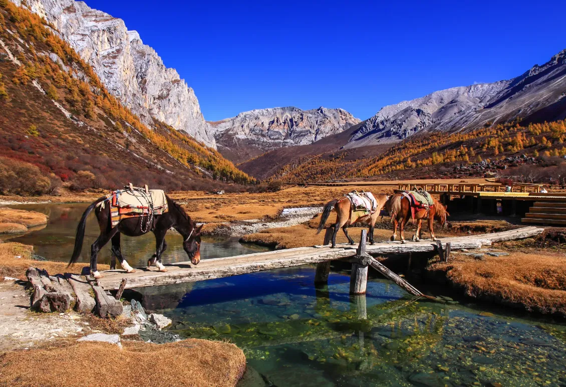
- Horse Caravan Note: A local horse caravan used to operate between Luorong and Sheshen Cliff, with limited capacity and only reaching that section—not extending to Milk Lake. Pricing and availability are subject to on-site conditions; do not believe claims of 'horse rides directly to the lakes'.
- Difficulty Warning: The Sheshen Cliff to Milk Lake stretch involves nearly 400 meters of elevation gain—the most challenging part of the entire route. Additional steep gravel slope remains before reaching Five-Colored Sea, with strong winds and low oxygen levels.
- Recommended For: Young adults with prior high-altitude hiking experience, who have already acclimatized during the previous two nights and show no symptoms of altitude sickness; not recommended for elderly people, children, or those with heart or lung conditions.
Two Routes Compared
| Comparison Item | Ordinary Experience Route | Jin Gang Challenge Route |
|---|---|---|
| Positioning | Mainly for mountain viewing and acclimatization, leisure-focused | Long-distance summit climb, hardcore hiking |
| Key Points | Chonggu Temple, Zhenzhu Lake, Luorong Pasture | Luorong Pasture, Sheshen Cliff, Milk Lake, Five-Colored Sea |
| Elevation Range | 2,900–4,100 meters | 2,900–4,700 meters |
| Hiking Distance | Approximately 3–5 km | Approximately 12–16 km round trip |
| Duration | 4–6 hours | Duration 4–6 hours 6–8 hours |
| Transportation Connection | Primarily shuttle bus + electric trolley | Shuttle bus + electric trolley + full hiking |
| Suitable For | First-day acclimatization, elderly and children, one-day visitors | Young adults with high-altitude experience and hiking or mountaineering enthusiasts |
| Altitude Sickness Risk | Lower | Higher—requires at least one night of acclimatization |
Transportation Options
- By Air: Fly from Daocheng Yading Airport (elevation ~4,411 m) to Chengdu/Chongqing/Xi'an, then shared or private car to Shangri-La Town. Direct flights land at high altitude, increasing altitude sickness risk—recommended to stay overnight in town before entering the valley.
- By Self-Drive/Bus: Chengdu → Ya’an → Kangding (Ya-Ye Expressway/G318) → Xinduqiao → Litang → Daocheng → Shangri-La Town, navigate to "Yading Visitor Center"; approximately 758 km, driving time around 13 hours. Best to split into 2–3 days for comfort. Private cars can only park at visitor center; entry into core area requires transfer to tourist shuttle buses.
- No Direct High-Speed Rail: Unlike Jiuzhaigou and Huanglong which have dedicated stations, Yading relies on air and road transport. Choose flight if time is tight; choose land route gradually for lower altitude sickness risk.
Important Notes
- Acclimatize at 2,900 meters in Shangri-La Town; Yading Village is about 4,060 meters, Luorong is 4,180 meters, and the lakes are over 4,500 meters—be aware of health risks from altitude sickness.
- Carry supplemental oxygen, ibuprofen, and glucose; use a thermos to drink hot water.
- Walk slowly on the challenging route—do not run or jump. The continuous ascent from She Shen Ya to Niunai Hai may cause headaches, nausea, chest tightness, or shortness of breath—immediately descend to Luorong or Zha Guan Beng and seek help.
- Drones are prohibited by official regulations, as are pets, leaving the trail, and open fires in the wild.
Packing List
| Category | Item | Notes |
|---|---|---|
| Documents | Passport | Reservations, sightseeing bus, hotel |
| Clothing | Waterproof jacket + fleece or lightweight down jacket | Extreme temperature differences at high altitudes |
| Shoes & Socks | Non-slip hiking shoes + thick socks | The She Shen Ya section has loose gravel—avoid new shoes |
| Sun Protection | Sunglasses, hat, lip balm, sunscreen | Intense UV radiation plus snow reflection at high altitudes |
| Hiking Gear | Walking poles, raincoat, backpack | The park shuttle only goes to Luorong—the lake section requires full walking |
| Medications | Ibuprofen, oxygen canisters, stomach medicine | To address health issues caused by altitude sickness |
| Electronics | Power bank | No charging stations available along the hiking route |
| Supplies | Chocolate, energy bars, sports drinks | Few supplies along the challenging route; no restaurants in the lake area |
Scan with your phone to follow.